News & announcements
Saving your history
Early accounts
Maps
Nearby towns
People
Churches
Schools
Municipal
Organizations
Businesses
The mines
Transportation
Streets
Buildings
Entertainment
Celebrations
Sports
Ethnic groups
1939 map of Freeland, Pa., annotated
 This remarkable map
was given to the late
Charlie Reczkowski several years ago. He was kind enough to lend it to
me so that I could scan or photograph it. As it turned out, the size of
the map exceeded what could be handled by my scanner or by any camera
set-up I could rig up. I took it to the library where I work, and again
it was too large for the camera set-up that we were using there to
photograph items from our collections. Fortunately, one of the other
libraries on campus had a more accommodating arrangement that enabled
them
to digitally photograph large architectural blueprints, and they were
very kind in agreeing to photograph this map for me. Even with their
set-up, they were unable to get the complete map in one image, so they
shot it in two ways: once as left and right halves, and once with
most of the map in one piece, and then the bottom several inches as a
separate piece. The copy at right is pieced together from that second
set of images. I subsequently
returned the original map to Charlie, and am sharing images of the map
here.
This remarkable map
was given to the late
Charlie Reczkowski several years ago. He was kind enough to lend it to
me so that I could scan or photograph it. As it turned out, the size of
the map exceeded what could be handled by my scanner or by any camera
set-up I could rig up. I took it to the library where I work, and again
it was too large for the camera set-up that we were using there to
photograph items from our collections. Fortunately, one of the other
libraries on campus had a more accommodating arrangement that enabled
them
to digitally photograph large architectural blueprints, and they were
very kind in agreeing to photograph this map for me. Even with their
set-up, they were unable to get the complete map in one image, so they
shot it in two ways: once as left and right halves, and once with
most of the map in one piece, and then the bottom several inches as a
separate piece. The copy at right is pieced together from that second
set of images. I subsequently
returned the original map to Charlie, and am sharing images of the map
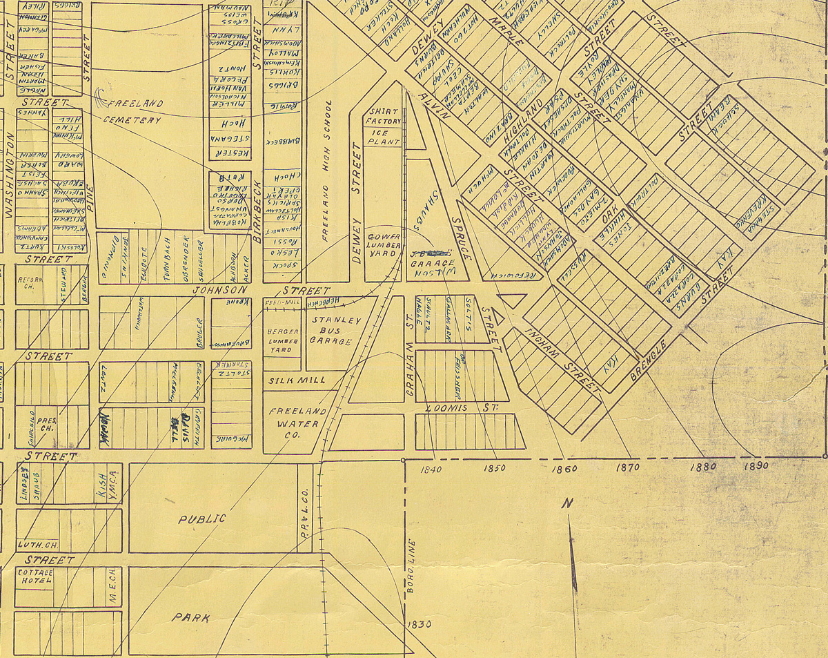
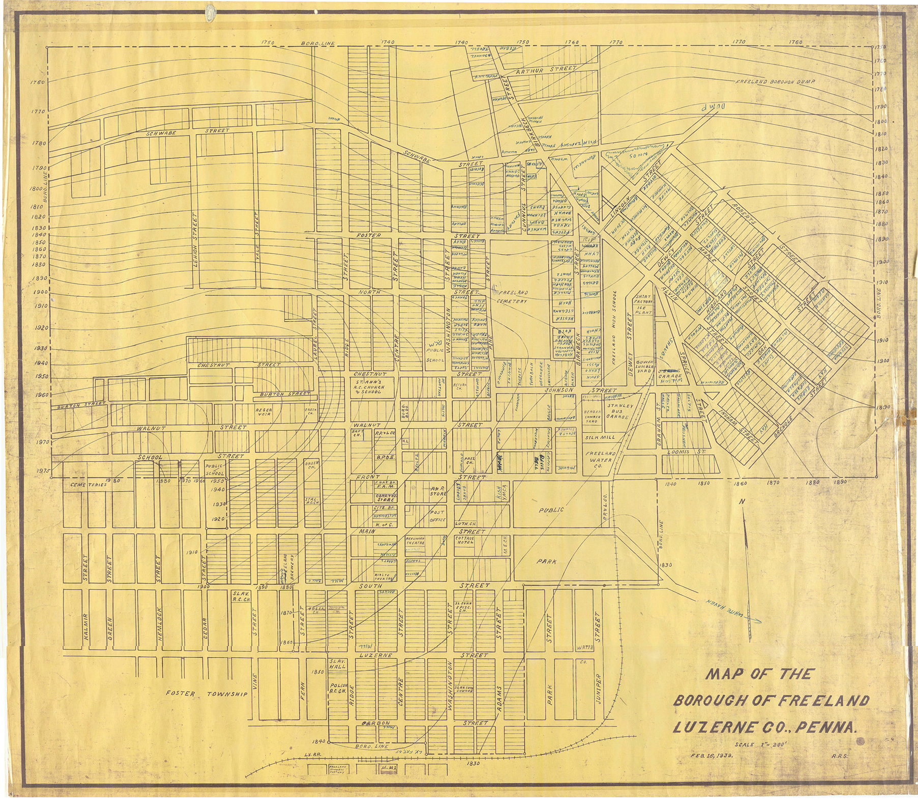
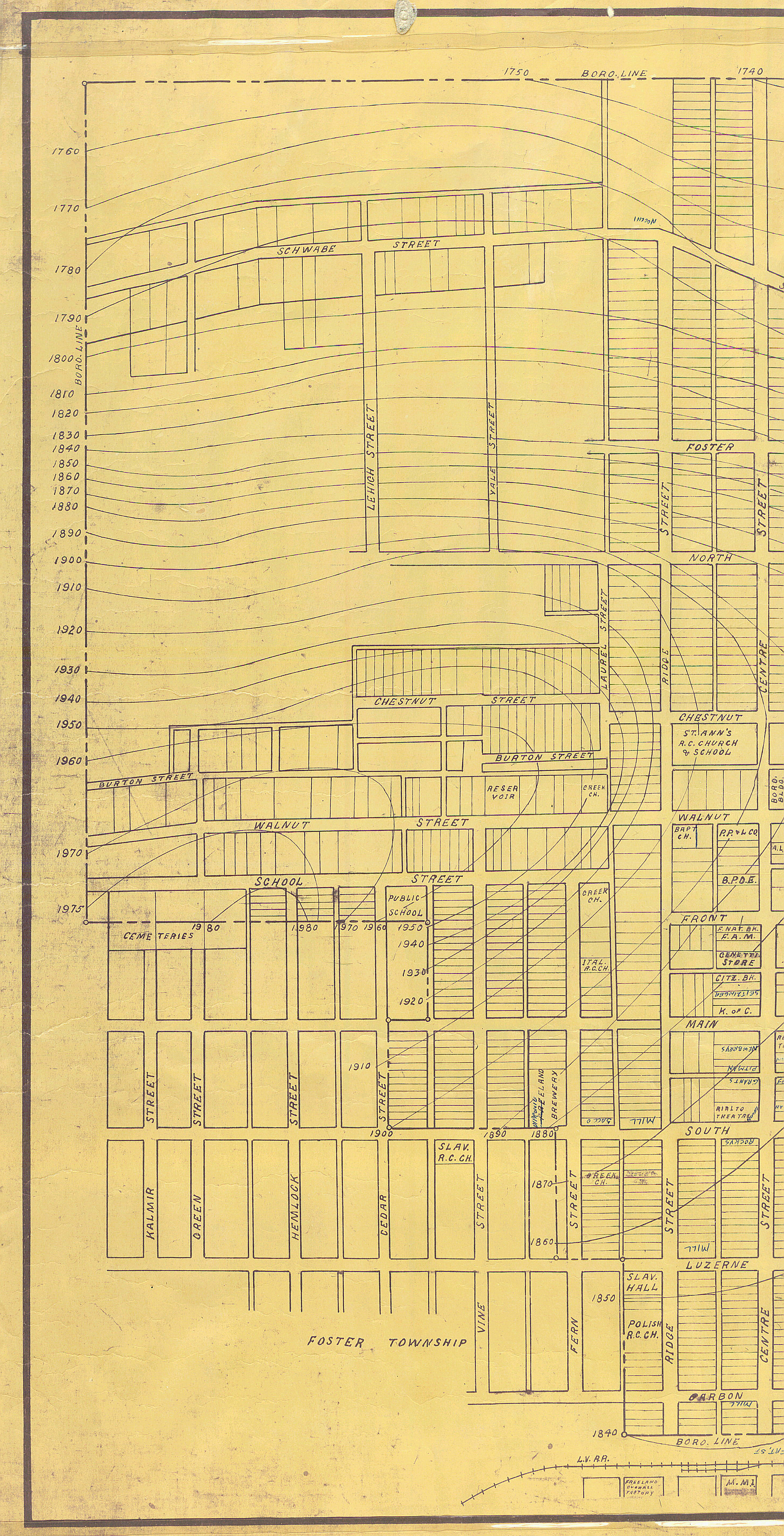
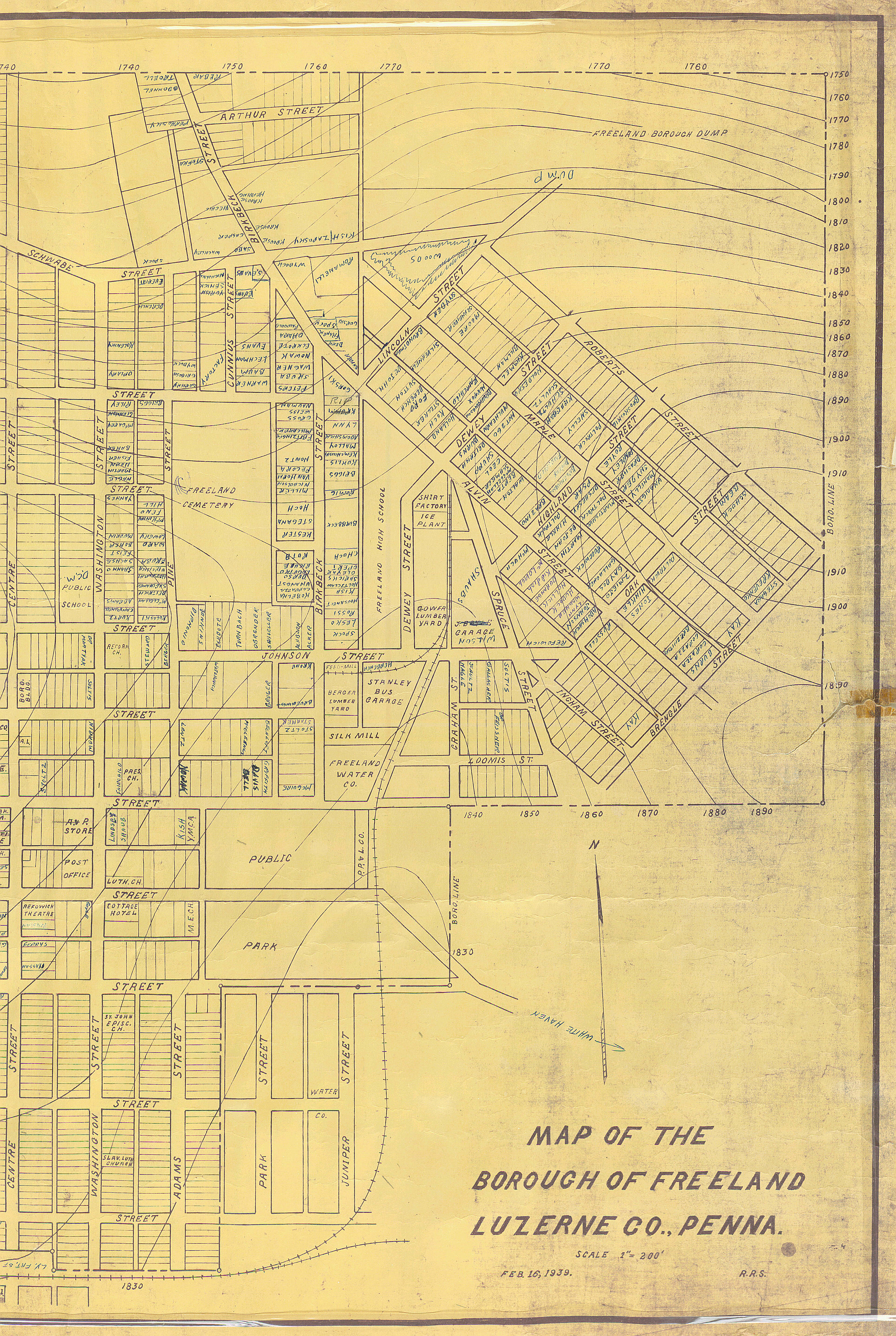
here.The legend of the map says: "Map of the Borough of Freeland, Luzerne Co., Penna., Scale 1"=200', Feb. 16, 1939, R.R.S." Foster township is indicated in the southwest corner without any actual boundary line. The dump is shown in the northeast corner. The wavy lines with four-digit numbers appear to be topographical information about elevations. That in itself would make the map unlike others that I have seen for Freeland, but beyond that, someone (the person who gave it to Charlie?) actually annotated parts of the map with the surnames of persons who lived at or had a business at a particular site. This makes it a unique resource for those interested in Freeland's history.
 I had difficulty
in making a smaller copy of the complete map in
a relatively compact file size (for users) that was still readable when
enlarged. Thus I'm posting it here in two halves. You can refer to the
full image above for general
purposes, and to these half-maps for better detail. The left image is
2.9 MB and the right one is 4.2 MB.
I had difficulty
in making a smaller copy of the complete map in
a relatively compact file size (for users) that was still readable when
enlarged. Thus I'm posting it here in two halves. You can refer to the
full image above for general
purposes, and to these half-maps for better detail. The left image is
2.9 MB and the right one is 4.2 MB.If anyone can tell me more about this map, I would be grateful for the information and can share it here. Thanks, and enjoy.