News & announcements
Saving your history
Early accounts
Maps
Nearby towns
People
Churches
Schools
Municipal
Organizations
Businesses
The mines
Transportation
Streets
Buildings
Entertainment
Celebrations
Sports
Ethnic groups
Freeland fire preparedness noted on Sanborn maps
Freeland's fire protection and firefighting readiness was noted on the Sanborn Fire Insurance maps.
On the first page of each town's or city's Sanborn Fire Insurance maps is a label and a brief statement about their water facilities, fire department, roads and lighting. Here are those statements from the Freeland maps for 1895, 1900, 1905, 1912, 1923.
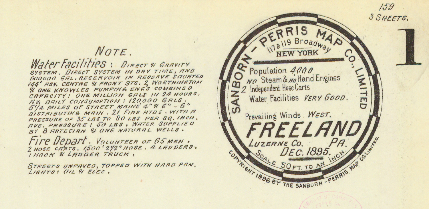
In addition to fire preparedness notes, the map says that Freeland's streets are unpaved and topped with hard pan, and lighting is a combination of oil and electric. Population is noted as 4,000.
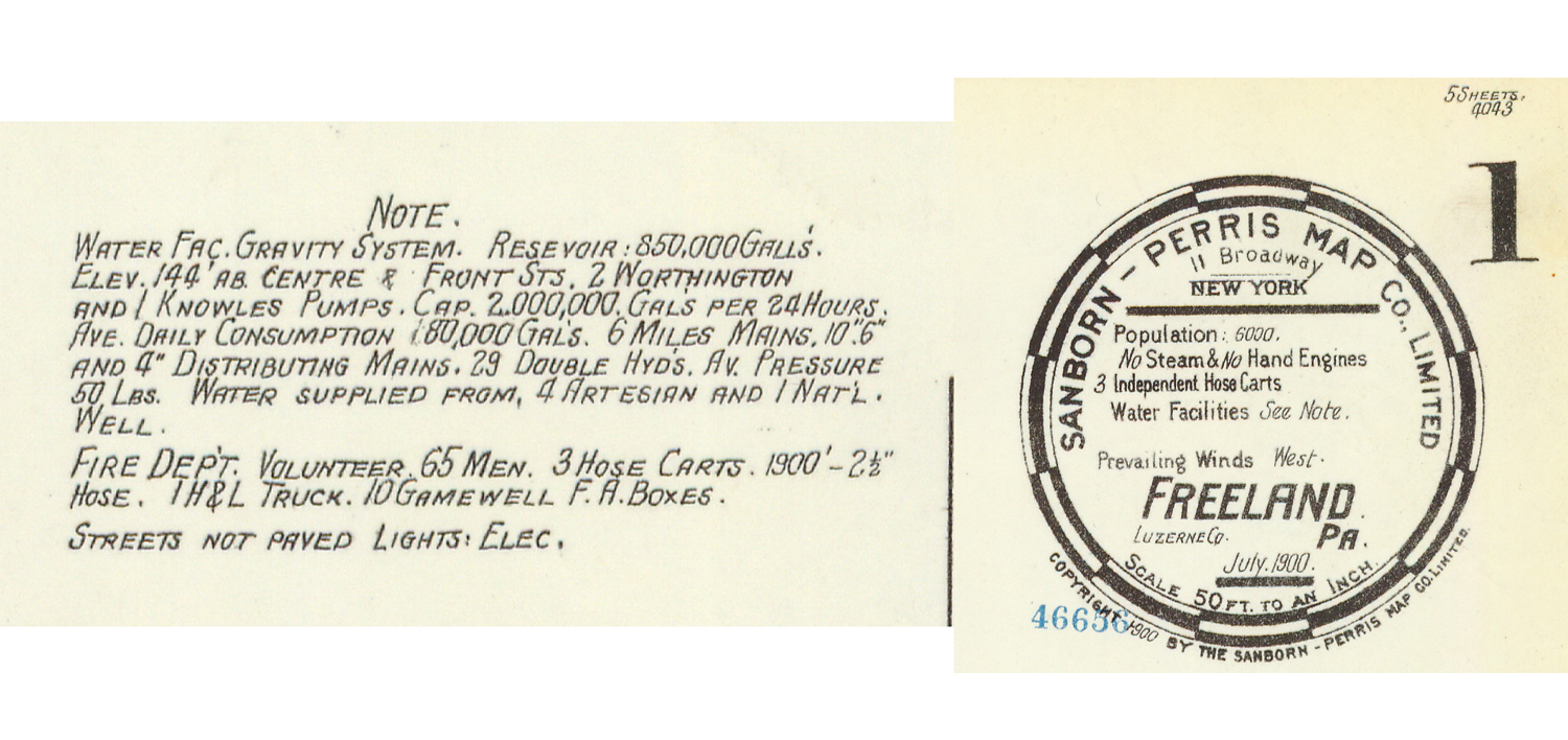
The map notes that streets are unpaved and lighting is electric. Population is noted as 6,000.
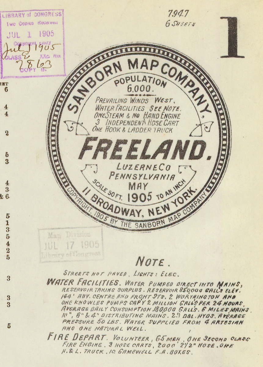
The map notes that streets are unpaved and lighting is electric. Population is noted as 6,000.
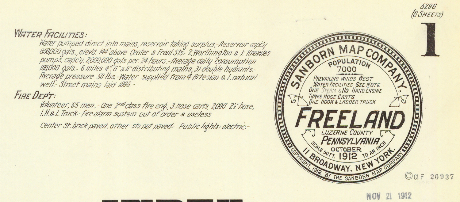
The map notes that Centre Street is brick-paved, other streets unpaved, and public lighting is electric. Population is noted as 7,000.
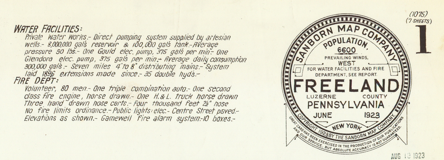
The map notes that Centre Street is paved, and public lighting is electric. Population is noted as 6,600.